Index >
Augrabies Falls Park
Guide to accommodation descriptions
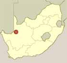
Location of
Augrabies Falls
National Park
Augrabies Falls National Park
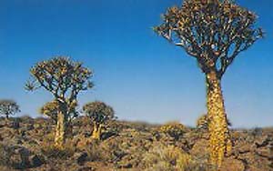
 The Augrabies Falls National Park, an hour from Upington, comprises an area of 820 sq km and characterised by the 18 kilometer abyss of the Orange River Gorge and craggy outcrops dominating scrub-dotted plains. The vegetation is suited to the arid desert climate. The Kokerboom, or Quiver Tree grows here, they are succulents and can store huge amounts of water in their stems and so survive long periods of drought. The park contains a game reserve with rhinos as the main attraction.
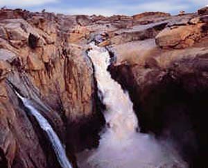
This park is located in the Northern Cape Province approximately 120kms west of Upington, featuring the Augrabies Falls, where the Orange River drops into a solid granite ravine. The main falls drop 56 metres and is quite impressive, particularly during the rainy season. Most the mammals in the park are small and include, klipspringer antelope, squirrel, rock dassie, although recently introduced to the park, on the north bank of the river, are black rhino, eland, springbok and kudu.
Accommodation
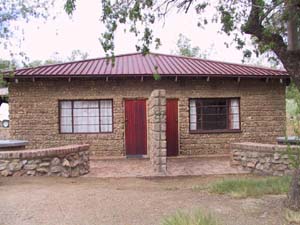 Family cottages
- Four-bed, two bedrooms, bathroom (bath), air-conditioning and equipped kitchen.
Bungalows
- (3 or 4 persons), bathroom (shower), air-conditioning and equipped kitchen.
- Two three-bedded bungalows have been adapted for persons with mobility impairments.
Caravan and camping sites
- A maximum of six persons, one caravan/tent and one vehicle or one autovilla permitted per sight.
- Communal camp kitchen with two-plate stoves, sinks, communal ablution facilities, laundry and ironing room.
- All sites have power points.
Day Visitors
- Picnic area for Day Visitors with ablution and barbeque facilities, and a swimming pool.
 Facilities
- Three swimming pools for residents.
- Shop, Shibula Restaurant.
- Public telephones, fuel.
- Information on birds, reptile and mammal species found in the park, is available at reception on request
- Conference Facilities
Extra Information
- Waterfall viewpoints walking distance from the restaurant complex.
- Klipspringer Hiking Trail: 3 days, 2 nights with a maximum of 12 persons per group, and minimum of 2 persons per group. Advance booking essential. Closed October to March due to heat.
- Dassie Nature trails: This 5km self-guided hiking trail leads you on a circular route starting at the Rest Camp, following along the gorge to Arrow Point, then heading out into the veld at the Potholes and Moonrock before heading back to the Rest Camp. Information brochures which include a map and information about various points along the trail are available at reception.
- Arrow Point (one hour)
- Potholes (one hour)
- Moon Rock (one hour).
- Night drives: minimum 4 persons required to secure.
- Gariep 3-in-1 Adventure: This is a three-part adventure comprising canoeing for 3 km down the mighty Orange River, walking for 4 km and returning to camp by mountain bike (11 km). Enquiries and reservations at the park.